 UTM Calculator - UTMCalc
© Michael & Roland O'Leary
A great Windows utility for:Servicemen - Hunters - Fishermen - HikersDo you use military style topographical maps to navigate in the woods? Do you plan your trips, making sure you know your route data before you depart? Do you record data in the woods, and want an easier way to calculate the distance and direction back in to that special place? |
Download a shareware version now. (Self-extracting file - 480 Kb)
![]() UTMCalc can simplify your planning and preparations by doing the tough calculations for you. UTMCalc is a windows program for executing map data calculations for military style topo maps. It will be a useful utility for:
UTMCalc can simplify your planning and preparations by doing the tough calculations for you. UTMCalc is a windows program for executing map data calculations for military style topo maps. It will be a useful utility for:
- hunters, fishermen and hikers when planning trips in the woods
- orienteers for checking practice calculations, or for preparing route data
- military personnel for preparing navigation training or checking students' manual calculations
- surveyors or landowners for quick map based calculations
- anyone else who uses topo map data.
UTM Calc offers the following features:
(Use the name links to see the appropriate program screenshot.)
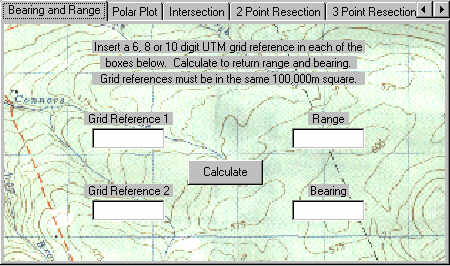 |
Bearing and Range - determine the distance and direction between two map spot grids | |
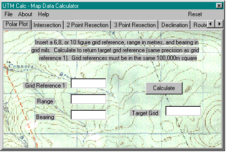 |
Polar Plot - calculate a destination grid from a known point, distance and direction | |
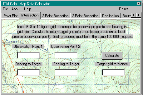 |
Intersection Calculator - calculate a target grid from two known points and the directions from those points to the target | |
 |
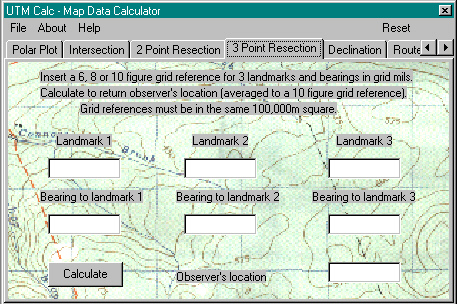 |
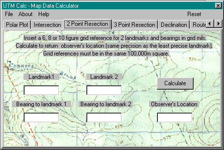
Two and Three Point Resections - find a location from bearings to two or three landmarks |
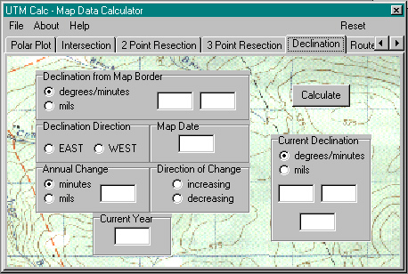 |
Declination - calculate the current difference between magnetic and grid north for your map | |
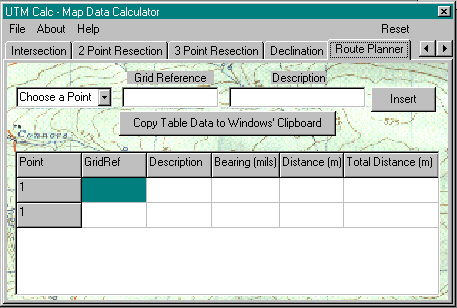 |
Route Planner - insert up to ten grid references, the calculator will give distance and direction for each leg of the route, including the data back to the start point and a total distance. The Route Planner data can be copied to the Windows Clipboard for insertion in other programs | |
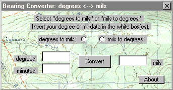 |
Also Available - a mil/degree-minute bearing converter. This program is available here for you to download. (Self-extracting file - 295 Kb) | |

- The O'Leary Collection; Medals of The Royal Canadian Regiment.
- Researching Canadian Soldiers of the First World War
- Researching The Royal Canadian Regiment
- The RCR in the First World War
- Badges of The RCR
- The Senior Subaltern
- The Minute Book (blog)
- Rogue Papers
- Tactical Primers
- The Regimental Library
- Battle Honours
- Perpetuation of the CEF
- A Miscellany
- Quotes
- The Frontenac Times
- Site Map
QUICK LINKS
The Guide is now available through the Amazon Kindle Store.

NOTE: File downloads total 2.25 Mb.
Cover Page
Copyright Notice
Table of Contents
Foreword
Chapter 1
Chapter 2
Chapter 3
Chapter 4
Chapter 5
Chapter 6
Chapter 7
Chapter 8
Chapter 9
Annex A - Shoot Rules
Annex B - Formulae
Table I
Table II
Table III
Annex C - Inspection Checklist